
As Big as Texas - The Makings of the LBJ Express
After opening the first segment of the LBJ Freeway in North Dallas in 1967, the highway quickly became congested by the early 1980s because of rapid growth in the region. Through a series of challenges over two decades, the Texas Department of Transportation (TxDOT), North Central Texas Council of Governments Regional Transportation Council (NCTCOG/RTC) and local Dallas officials put together a plan that laid the groundwork for a significant infrastructure evolution.
The final innovative design included ten general-purpose lanes in each direction, two HOV lanes and four elevated express lanes, along with added frontage roads, new bridges and ramps.
The city of Dallas and business leaders demanded that the new highway should be no higher and no wider, so in 2006, TxDOT approved a design that included a trenched open channel to add capacity, instead of bored tunnels, saving $1 billion in construction costs. By 2009, regional leaders had committed public funds and the Texas Legislature approved a Public Private Partnership Comprehensive Development Agreement (P3 CDA) for the LBJ project. The P3, led by Cintra, a Ferrovial company, currently includes Meridiam Infrastructure and APG Asset Management, which forms LBJ Infrastructure Group. This partnership utilized Private Activity Bonds (PABs), a TIFIA loan, equity investment and a small percentage of public funds, and took on the risks of financing, designing, building, operating and maintaining the new highway.
The new entity worked side by side with partner Ferrovial Construction and Webber, a Ferrovial company, to complete the $2.7-billion project six months ahead of schedule.
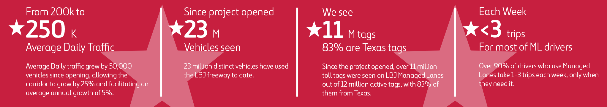
Over the past decade, the LBJ Express project has created nearly $7 billion in economic impact within the North Texas region and $1.5 billion in socioeconomic impacts.
The LBJ: A Highway of Historic Proportions
Milestones in Motion:
1967: The journey began with the opening of the first three-mile section from I-35E to the east (near Marsh Lane). By the end of the year, the other sections began to open, marking a significant milestone in Dallas’s transportation network.
1978: The southern terminus of I-635 was truncated with the completion of I-20, reshaping the Interstate’s path.
1981: The northern terminus towards DFW Airport opened to traffic, further enhancing connectivity in the region.
1997: High-Occupancy Vehicle (HOV) lanes were added from I-35E to US 75, improving traffic flow.

Highway Firsts
1970: LBJ became the first highway in the United States to use High-Mast lighting towers that were designed by what was known then as the Texas Highway Department.
2005: The reconstruction of the interchange at US 75 resulted in the creation of the “High Five,” the largest and highest highway stack in Texas at the time. This engineering marvel became a landmark in Dallas.
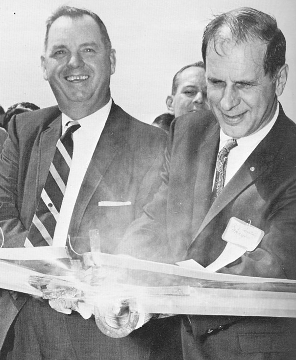
2009: The LBJ Express project was announced, marking the first and largest Public-Private Partnership (P3) in Texas. This ambitious project aimed to transform the LBJ Freeway into a state-of-the-art transportation corridor.
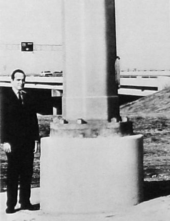
2015: First use of a cantilever design for a highway in North Texas, saving $1 billion in cost.
Construction Highlights
The impact of this project created more than 9,000 local construction jobs along the corridor, representing more than 200 local and regional companies. There were 190+ DBE awarded contracts, and the team exceed the DBE goal.
subcontractors/suppliers performed work
traffic shifts
lane closures
cubic yards excavated
Utility conflicts with 23 owners
linear feet of drilled shafts
square feet of bridge decks
square feet of retaining walls
Economic Impact
The North Dallas area experienced an economic peak in the late 1980s, followed by a rapid decline by the year 2000. However, with the opening of the LBJ Express, the area has since flourished, becoming one of the most profitable economic zones in Dallas.
Before:
This aerial photograph, taken in 2005, depicts the LBJ Freeway as a “Second Generation Freeway,” originally designed and constructed by the Texas Highway Department (THD) in the late 1960s. In the 1980s and 1990s, the Texas Department of Transportation (TxDOT) implemented modifications, including the addition of frontage roads at the DNT and the introduction of centralized High Occupancy Vehicle (HOV) lanes.
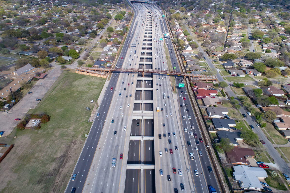
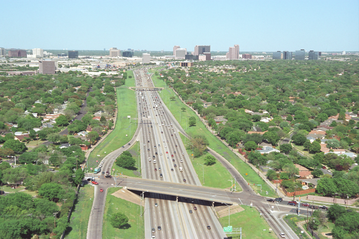
After:
This aerial image captures the LBJ Freeway following the 2015 completion of the LBJ Express project. The modernized freeway features expanded general-purpose lanes, continuous frontage roads, and below-grade express lanes. This latest generation design significantly increases capacity and reduces congestion.